

Villiers-sous-Grez
Villiers-sous-Grez


This village is located in the forest of Fontainebleau and more precisely in the Bois de la Commanderie. Situated 7 kilometres from Nemours and 15 from Fontainebleau, the village also includes the hamlet of Busseau, in the middle of the forest, a good kilometre from the village.
The Town Hall has created a discovery route of the village starting from the church. It will allow you, among other things, to discover :
- The Larry: At the exit of the village, along the road leading to Nemours, below the Rocher Saint-Étienne, since ancient times, the village community has met to relax or celebrate happy moments in this space which separates the last houses of the village from the forest.
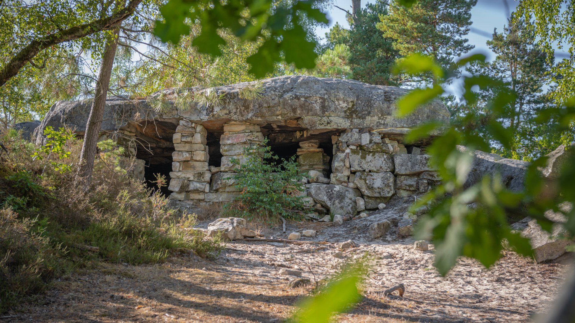
- The Rocher Saint-Étienne: By taking the sandy path from the Larry to the water tower, one climbs the most picturesque natural site in the commune, the Rocher Saint-Étienne. This sandy hill is oriented East-West, a formation zone of sandstone rocks very often found in the whole Fontainebleau massif. This sand hill forms an oval 600 metres long and 200 metres wide at its base. It culminates at an altitude of 125 metres, dominating the village by about 50 metres. A sandy path continues to the west on the narrow summit of the old sandstone plateau, the only remnant of which is the rocky shelter known as "La Grotte du Curé". A remarkable viewpoint...
- The Curé's Cave and St Etienne's Fountain: A sandstone slab partially covers the top of the sandy hill of St Etienne's Rock. It is clearly visible on the site of the Curé's Cave, a probable quarryman's shelter, a vestige of an activity which over time stripped the mound of its shell. The relief and the rock have allowed this place to play several roles in the history of Villiers-sous-Grez...

Tourist Information Centre
28, rue Gautier 1er - 77140 Nemours
